- Cities and buildings
- Fields, plains and deserts
- Forests
- Hills and mountains
- Islands and promontories
- Lands, realms and regions
- Rivers and lakes
- Seas and oceans
Take the Free mydiscprofile Personality Test to discover your core personality and your ideal job. Which personality type are you? |
Dates
Created at the beginning of the Second Age; destroyed II 3319
Location
The southeastern promontory of the island of Númenor
Race
Division
Culture
Settlements
Nindamos lay on the western borders of this region
Outflow
The course of the river Siril to its mouths formed the western border of the Southeastlands
Other names
Indexes: About this entry:
|
SoutheastlandsThe promontory of the HyarrostarRegions of Númenor 
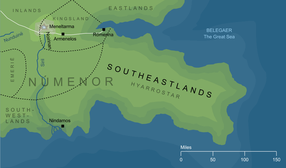
The island of Númenor had five great promontories extending out into the Great Sea, and each of these was named for the direction in which it lay from the central mass of the island. The southeastern of these was known as the Hyarrostar, translated as 'Southeastlands'. A wide, densely forested region, its western border, where it marched with the Hyarnustar or Southwestlands, was marked by the river Siril and the shoreland town of Nindamos. To the north, it was separated from the Orrostar (Eastlands) by a narrow inlet at whose head lay the great eastern haven of Rómenna. See also...Indexes: About this entry:
For acknowledgements and references, see the Disclaimer & Bibliography page. Original content © copyright Mark Fisher 2013, 2020-2021. All rights reserved. For conditions of reuse, see the Site FAQ. Website services kindly sponsored by Discus from Axiom Software Ltd.Use DISC to investigate the dynamics of any working relationship, with Discus' Relationship Assessment. |