The Encyclopedia of Arda - an interactive guide to the world of J.R.R. Tolkien
Dates
Created at the beginning of the Second Age; destroyed II 3319
Location
The southwestern promontory of the island of Númenor
Race
Division
Culture
Settlements
Eldalondë and Nindamos stood on the borders of this region
Other names

Indexes:

About this entry:

  • Updated 15 May 2017
  • This entry is complete

Southwestlands

The Hyarnustar of Númenor

Map of the Southwestlands

Regions of Númenor

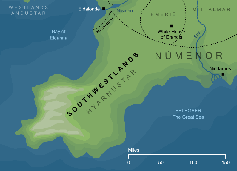
The long southwestern promontory of Númenor that lay to the south of the Bay of Eldanna. Its inland regions were most famous for their wine-making, but as it stretched out towards the sea, its southwestern uplands became mountainous, and ended in high sea-cliffs. Where the Southwestlands met the Southeastlands, the Siril - the greatest river in Númenor - ran between the two lands, and where it flowed into the sea stood the fishing port of Nindamos, the most important settlement in this part of Númenor.


See also...

Southeastlands

Indexes:

About this entry:

  • Updated 15 May 2017
  • This entry is complete

For acknowledgements and references, see the Disclaimer & Bibliography page.

Original content © copyright Mark Fisher 2011, 2013, 2017. All rights reserved. For conditions of reuse, see the Site FAQ.

Website services kindly sponsored by Discus from Axiom Software Ltd.
Discus DISC profiling: bringing technology to team building, assessment and relationship management.
The Encyclopedia of Arda
Menu
Homepage Search Latest Entries and Updates Random Entry