- Cities and buildings
- Fields, plains and deserts
- Forests
- Hills and mountains
- Islands and promontories
- Lands, realms and regions
- Rivers and lakes
- Seas and oceans


 |
||
|


Which personality type are you?
Take the Free mydiscprofile Personality Test to discover your core personality and your ideal job.   Which personality type are you? |
|
Dates
A Tower was built here c. II 3320, it was overrun and destroyed in III 1409 (these are the dates shown on the timeline)
Location
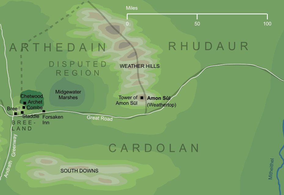
Eastward of Bree, at the southern end of the Weather Hills
Race
Division
Culture
Family
Held by descendants of the House of Isildur
Settlements
Pronunciation
a'mon soo'l
Meaning
Literally 'hill of wind', but translated 'Weathertop'
Other names
Indexes: About this entry:
|
Amon SûlThe hill that Men called Weathertop
The Elvish name for the hill better known by its Mannish name, Weathertop. It lay at the southern end of the Weather Hills. Amon Sûl stood near the centre of the ancient North-kingdom of Arnor, and Elendil built a tall tower on its summit to hold the chief palantír of his realm. In later days, Arnor broke into three smaller kingdoms, and the Tower of Amon Sûl marked the point where the three met. The Tower was destroyed at last by the forces of Angmar, but its palantír was rescued and carried away to Fornost. At the end of the Third Age, the Tower of Amon Sûl had been a ruin for centuries, but the hill still marked the highest point for many miles in any direction. It was here that Gandalf battled the Black Riders, and later Frodo was wounded by them in a hollow beneath the hill. See also...Cardolan, Elendil, Prince of Cardolan, Seeing-stones, Stone of Amon Sûl, Stone of Annúminas, Stones of Arnor, Súlimo, Tower of Amon Sûl, Weather Hills, Weathertop Indexes: About this entry:
For acknowledgements and references, see the Disclaimer & Bibliography page. Original content © copyright Mark Fisher 1998, 2001, 2002, 2006, 2012. All rights reserved. For conditions of reuse, see the Site FAQ. Website services kindly sponsored by Discus from Axiom Software Ltd.Discus creates personality test reports in natural language tailored to each individual DISC personality profile. |