- Cities and buildings
- Fields, plains and deserts
- Forests
- Hills and mountains
- Islands and promontories
- Lands, realms and regions
- Rivers and lakes
- Seas and oceans


 |
||||||
|


Which personality type are you?
Take the Free mydiscprofile Personality Test to discover your core personality and your ideal job.   Which personality type are you? |
|
Dates
Constructed in the late Second Age1
Location
Origins
Created by the Gondorians early in their kingdom's history
Race
Division
Culture
Important peaks
Meaning
Wain is an old word for 'wagon' or 'cart'; the valley was made for the passage of wagons hauling stone
Other names
Said to be a translation of Elvish Imrath Gondraich
Indexes: About this entry:
|
Stonewain ValleyThe ancient way of the quarrymen of Gondor
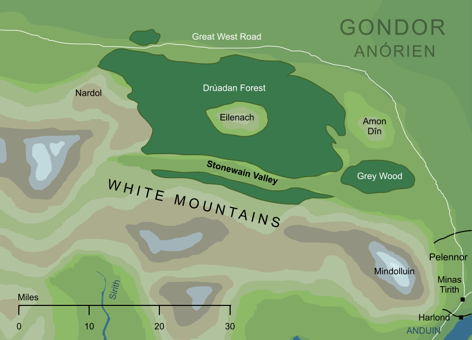
A long straight valley in the eastern White Mountains. It was made in ancient days by the Men of Gondor, as a route from the quarries beneath Nardol to Minas Anor. By the time of the War of the Ring, it was forgotten by all but the Woses of the Drúadan Forest, who revealed it to the Rohirrim so that they could come to the aid of Gondor in the Battle of the Pelennor. Notes
See also...Dîn, Drúedain of Anórien, East Anórien, Full Muster, Ghân, Grey Wood, High Nazgûl, Horse-men, Ingold, Min-Rimmon, Silent Hill, Tawar-in-Drúedain, White Mountains Indexes: About this entry:
For acknowledgements and references, see the Disclaimer & Bibliography page. Original content © copyright Mark Fisher 2000, 2019. All rights reserved. For conditions of reuse, see the Site FAQ. Website services kindly sponsored by Discus from Axiom Software Ltd.With Discus our world-class support is free for all users. We believe in empowering clients to get the most from the DISC test. |