- Cities and buildings
- Fields, plains and deserts
- Forests
- Hills and mountains
- Islands and promontories
- Lands, realms and regions
- Rivers and lakes
- Seas and oceans


 |
||
|


Which personality type are you?
Take the Free mydiscprofile Personality Test to discover your core personality and your ideal job.   Which personality type are you? |
|
Dates
Created at the beginning of the Second Age; destroyed II 3319
Location
The southwestern promontory of the island of Númenor
Race
Division
Culture
Settlements
Other names
Indexes: About this entry:
|
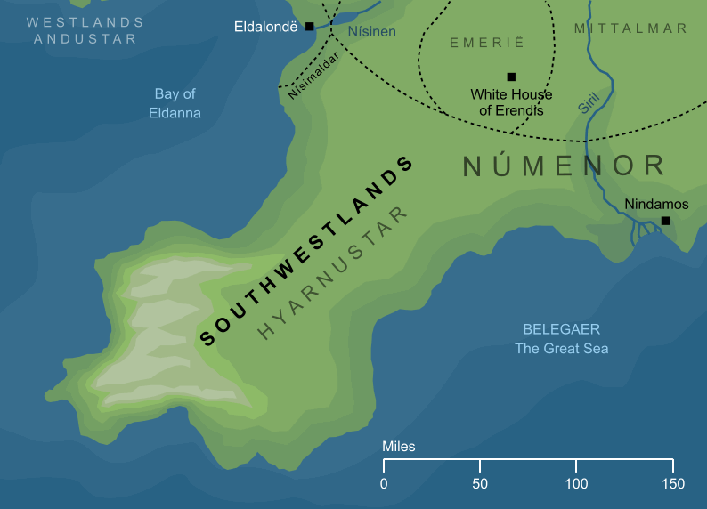
SouthwestlandsThe Hyarnustar of Númenor
Regions of Númenor The long southwestern promontory of Númenor that lay to the south of the Bay of Eldanna. Its inland regions were most famous for their wine-making, but as it stretched out towards the sea, its southwestern uplands became mountainous, and ended in high sea-cliffs. Where the Southwestlands met the Southeastlands, the Siril - the greatest river in Númenor - ran between the two lands, and where it flowed into the sea stood the fishing port of Nindamos, the most important settlement in this part of Númenor. See also...Indexes: About this entry:
For acknowledgements and references, see the Disclaimer & Bibliography page. Original content © copyright Mark Fisher 2011, 2013, 2017. All rights reserved. For conditions of reuse, see the Site FAQ. Website services kindly sponsored by myDISCprofile, the free online personality test.Explore the benefits of using a personality profile to discover yourself and make the most of your career. |