- Cities and buildings
- Fields, plains and deserts
- Forests
- Hills and mountains
- Islands and promontories
- Lands, realms and regions
- Rivers and lakes
- Seas and oceans


 |
||||
|


Which personality type are you?
Take the Free mydiscprofile Personality Test to discover your core personality and your ideal job.   Which personality type are you? |
|
Location
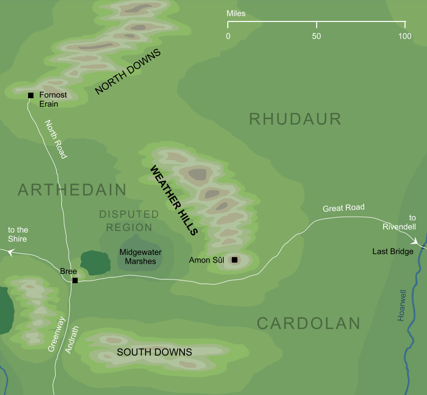
Running north to south for some hundred miles through central Eriador
Race
Fortified by Men
Division
Culture
Settlements
Important peaks
Meaning
The meaning of 'weather' in this context is unclear1
Indexes: About this entry:
|
Weather HillsThe range of hills running north from Weathertop
The name among Men for the north-south range of hills that lay in central Eriador, and in ancient times marked part of the border between the lands of Arthedain and Rhudaur. Weathertop, or Amon Sûl, lay at the southern end of the range. Notes
See also...Amlaith of Fornost, Amon Sûl, Angmar, Argeleb I, Cardolan, Frodo Baggins, King of Arthedain, Kingdoms of the Dúnedain, Midgewater Marshes, Mount Gram, Prince of Cardolan, Weathertop, Witch-realm of Angmar Indexes: About this entry:
For acknowledgements and references, see the Disclaimer & Bibliography page. Original content © copyright Mark Fisher 1998, 2001, 2016. All rights reserved. For conditions of reuse, see the Site FAQ. Website services kindly sponsored by myDISCprofile, the free online personality test.How do your personal strengths fit in with career matching? How can you identify them? Try a free personality test from myDISCprofile. |