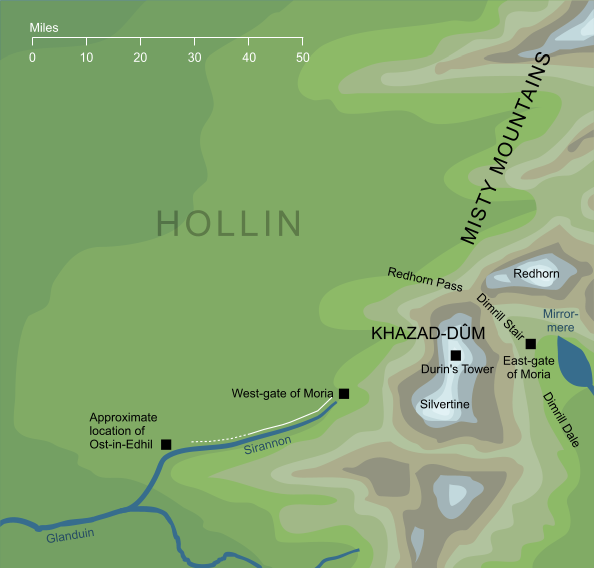
Map of Hollin (somewhat conjectural)1
Map of Hollin (somewhat conjectural)1
The name among Men for the land of Elves known as Eregion, that thrived in the lands west of Khazad-dûm during the early part of the Second Age. The name comes from the great holly trees that grew there.
Notes
1 |
We're not told the precise location of Ost-in-Edhil, the chief city of the Elves of Hollin. We do know that the road to the city from the West-gate of Khazad-dûm ran along the Sirannon for at least part of its length, so it seems reasonable to assume that the city probably lay somewhere on that stream, as shown here. It may possibly have stood on the larger Glanduin into which the Sirannon flowed, or elsewhere on the plains westward of the Misty Mountains, but it was clearly relatively close to Khazad-dûm. |
Indexes:
About this entry:
- Updated 8 November 2018
- Updates planned: 1
For acknowledgements and references, see the Disclaimer & Bibliography page.
Original content © copyright Mark Fisher 1998, 2001, 2017-2018. All rights reserved. For conditions of reuse, see the Site FAQ.
Website services kindly sponsored by myDISCprofile, the free online personality test.
How do your personal strengths fit in with career matching? How can you identify them? Try a free personality test from myDISCprofile.