- Cities and buildings
- Fields, plains and deserts
- Forests
- Hills and mountains
- Islands and promontories
- Lands, realms and regions
- Rivers and lakes
- Seas and oceans


|
||||
|


Which personality type are you?
Take the Free mydiscprofile Personality Test to discover your core personality and your ideal job.   Which personality type are you? |
|
Dates
Location
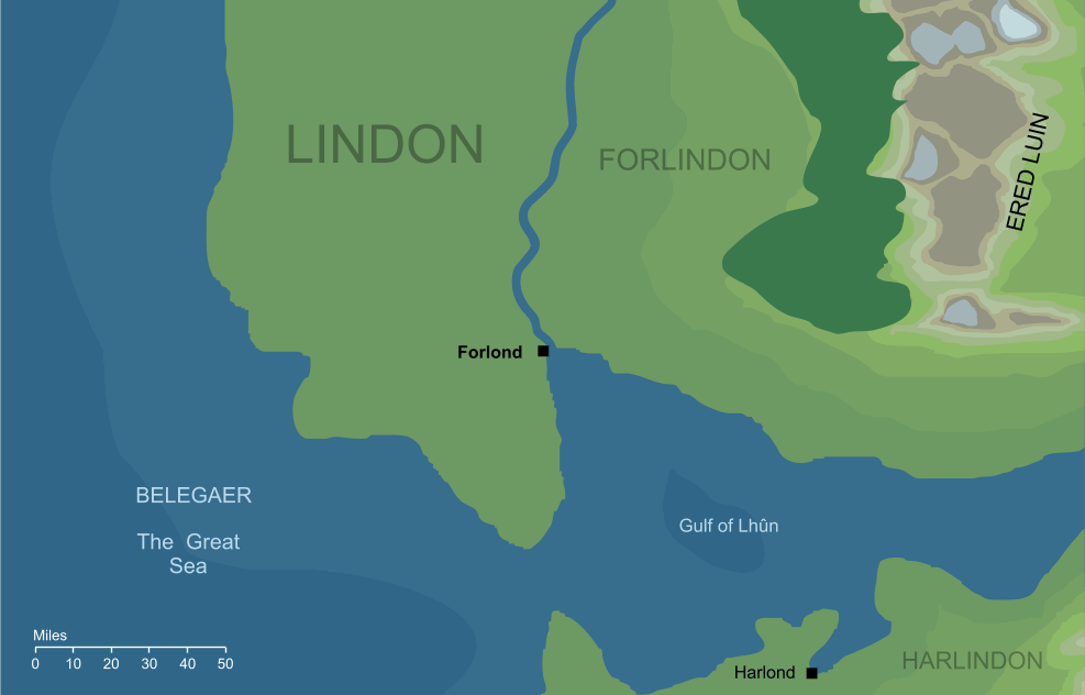
In Lindon, on a northern inlet running into the Gulf of Lhûn
Race
Culture
Outflow
The Forlond stood at the mouth of an unnamed river flowing out of Ered Luin, the Blue Mountains
Pronunciation
for'rrlond ('rr' emphasises that the r sound should be pronounced)
Meaning
'North haven'
Indexes: About this entry:
|
ForlondA harbour of the Elves of Lindon
The Forlond on the shores of the Gulf of Lhûn (slightly conjectural)1
The Forlond on the shores of the Gulf of Lhûn (slightly conjectural)1
A harbour that lay on the northern shore of the Gulf of Lhûn, in the Elvish land of Forlindon. The name Forlond is derived from the Elvish for 'north haven'. It had an equivalent on the southern shore, too: the Harlond or 'south haven'. Notes
See also...Indexes: About this entry:
For acknowledgements and references, see the Disclaimer & Bibliography page. Original content © copyright Mark Fisher 2003, 2021-2022. All rights reserved. For conditions of reuse, see the Site FAQ. Website services kindly sponsored by Discus from Axiom Software Ltd.Discover how DISC fits together with our FREE and comprehensive Complete Introduction to DISC. |