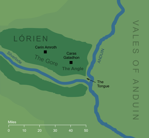
The main region of Lórien, lying between the arms of the river Silverlode and the Great River (or, in Elvish, Celebrant and Anduin). The Angle was known to its inhabitants as Egladil, and is not to be confused with the narrow land between the Rivers Hoarwell and Loudwater, far to the northwest, which was also known as 'The Angle'.
The maps that accompany The Lord of the Rings show Lórien as an approximate rectangle, with the course of Celebrant more or less perpendicular to that of Anduin, and so it may seem odd to refer to an 'Angle' between the two rivers. However, there are various references in the text to the sharpness of the angle where the rivers met, and it seems that the land of Lórien may have been rather longer and narrower than is shown in the familiar maps.
Indexes:
About this entry:
- Updated 1 July 2019
- This entry is complete
For acknowledgements and references, see the Disclaimer & Bibliography page.
Original content © copyright Mark Fisher 2005, 2018-2019. All rights reserved. For conditions of reuse, see the Site FAQ.