- Cities and buildings
- Fields, plains and deserts
- Forests
- Hills and mountains
- Islands and promontories
- Lands, realms and regions
- Rivers and lakes
- Seas and oceans


|
||||||||
|


Which personality type are you?
Take the Free mydiscprofile Personality Test to discover your core personality and your ideal job.   Which personality type are you? |
|
Dates
Location
Race
Culture
Family
Associated with the Took family
Pronunciation
too'kbank ('oo' as in English 'fool')
Meaning
'Hillside of the Tooks'
Indexes: About this entry:
|
TookbankA village of the Tookland
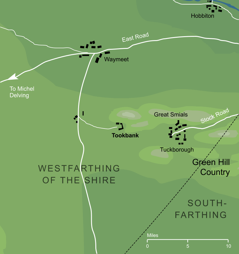
The smaller of the two main settlements of the Tookland, about seven miles to the west of Tuckborough, which was the larger of the two towns in the region. The name 'Tookbank' is clearly derived from the Tooks, in whose folkland it lay, combined with the word 'bank', meaning 'hillside'. Tookbank is geographically curious in that it does not appear to have been connected by road with its much larger neighbouring town of Tuckborough - indeed the only overland access to Tuckborough would involve a significant detour2 through Stock, far to the east. The Tooks may have made this arrangement intentionally, so that traders or other visitors to the Tookland would do their business through Tookbank and thus avoid their main township. Alternatively, it may be that the two villages were in fact connected, but by tunnel rather than by road; a seven-mile underground passage seems rather implausible, but was perhaps not beyond the renowned tunnelling capabilities of the Hobbits.3 Notes
See also...Indexes: About this entry:
For acknowledgements and references, see the Disclaimer & Bibliography page. Original content © copyright Mark Fisher 1998, 2001, 2012, 2016. All rights reserved. For conditions of reuse, see the Site FAQ. Website services kindly sponsored by Axiom Discovery aptitude and skill testing.Personality is one part of understanding a candidate's suitability, but aptitudes and skills are also key. |