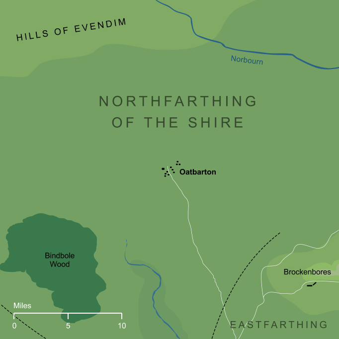
Oatbarton and surrounding area (largely conjectural)2
Oatbarton and surrounding area (largely conjectural)2
A village or township in the Northfarthing of the Shire, far to the north of Hobbiton. Very little detail is known about Oatbarton, except that it was large enough to merit its own road. Halfway between Bywater and Frogmorton, a road or path led away from the Shire's main East Road and ran northward towards Oatbarton. Though we don't know precisely where Oatbarton lay, we can say that this road ran for at least twenty miles from the East Road, and potentially farther still, before it reached the northern township. We do know that parts of the Northfarthing were given over to farmland, and the name 'Oatbarton', which means essentially 'oat farm', suggests that this settlement lay within the farthing's farming regions.
Notes
1 |
The old word 'barton' is commonly translated as simply 'farm' or 'farmyard', but historically it had more particular meanings. Its ultimate origin in Old English was as bær-tún, 'barley farm', but it developed over time to mean a farm worked for a local lord, or a grange used for storage. This latter might conceivably be relevant to the name 'Oatbarton', which could therefore be taken as 'grange for storing oats', though it's unclear whether Tolkien intended the name to be interpreted so precisely.
|
2 |
Our detailed geographical knowledge of the Shire is restricted to a region southward of Oatbarton, and so much of the map shown here is necessarily speculative. We know that there was a road running northward to Oatbarton in the direction shown, but we do not know precisely where Oatbarton itself stood. Other features shown here, such as the course of the Norbourn or the slopes of the Hills of Evendim, are also conjectural. These features must have been somewhere close to the locations shown on the map, but we do not know their geography with precision.
|
Indexes:
About this entry:
- Updated 14 August 2019
- This entry is complete
For acknowledgements and references, see the Disclaimer & Bibliography page.
Original content © copyright Mark Fisher 2007, 2017, 2019. All rights reserved. For conditions of reuse, see the Site FAQ.