- Cities and buildings
- Fields, plains and deserts
- Forests
- Hills and mountains
- Islands and promontories
- Lands, realms and regions
- Rivers and lakes
- Seas and oceans


|
||||
|


Which personality type are you?
Take the Free mydiscprofile Personality Test to discover your core personality and your ideal job.   Which personality type are you? |
|
Dates
Established after the foundation of the Shire in III 1601 (year 1 by the Shire-reckoning); certainly in existence by III 2670 (S.R. 1070)
Location
In the Southfarthing of the Shire
Race
Culture
Family
Associated with the Hornblower family
Meaning
'Long valley'
Indexes: About this entry:
|

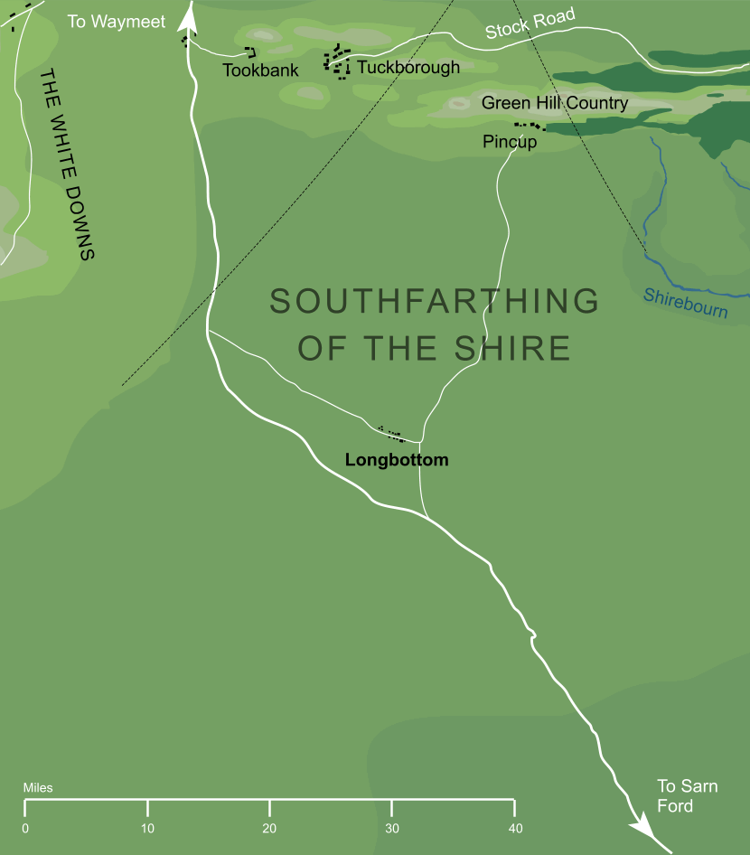
Map of Longbottom (partially conjectural)1
Map of Longbottom (partially conjectural)1
A village or town in the Southfarthing of the Shire. Its name means 'long valley', and we know that the village and its surroundings were sheltered from the elements, probably by the valley's sides. Longbottom entered history in about III 2670 (1070 by the Shire-reckoning), when a certain Tobold Hornblower introduced a new herb there. The valley's sheltered aspect, and the relatively warm climate of the Southfarthing, made the region around Longbottom ideal for growing this new plant, pipe-weed, which rapidly became the centre of a thriving industry. Longbottom Leaf remained one of the most famous varieties of the weed. Notes
See also...Folklands, Four Farthings, Hornblower Family, Longbottom Leaf, Old Toby, Old Toby, Pincup, Pipe-weed, Sharkey’s Men, Southfarthing of the Shire, Tobold Hornblower Indexes: About this entry:
For acknowledgements and references, see the Disclaimer & Bibliography page. Original content © copyright Mark Fisher 2001, 2011, 2022. All rights reserved. For conditions of reuse, see the Site FAQ. Website services kindly sponsored by Axiom Discovery aptitude and skill testing.Personality is one part of understanding a candidate's suitability, but aptitudes and skills are also key. |