- Cities and buildings
- Fields, plains and deserts
- Forests
- Hills and mountains
- Islands and promontories
- Lands, realms and regions
- Rivers and lakes
- Seas and oceans


 |
||
|


Which personality type are you?
Take the Free mydiscprofile Personality Test to discover your core personality and your ideal job.   Which personality type are you? |
|
Location
Race
Primarily occupied by Dwarves
Settlements
Source
The Little Lune rose in the eastern Ered Lindon, and another (unnamed) river had its source on the Mountains' western slopes
Important peaks
Pronunciation
e'red li'ndon
Meaning
Other names
Indexes: About this entry:
|

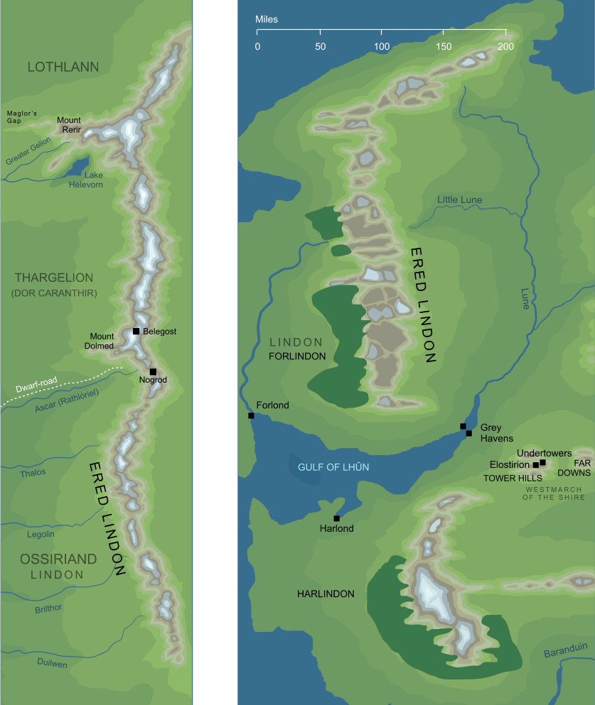
The map on the left shows Ered Lindon during the First Age, before the cataclysm that brought that Age to its end. The map on the right shows the later geography of the mountains, specifically in the early years of the Fourth Age.
The map on the left shows Ered Lindon during the First Age, before the cataclysm that brought that Age to its end. The map on the right shows the later geography of the mountains, specifically in the early years of the Fourth Age.
The mountain range that separated the Elven land of Lindon from Eriador, more commonly called Ered Luin or the Blue Mountains. See also...Indexes: About this entry:
For acknowledgements and references, see the Disclaimer & Bibliography page. Original content © copyright Mark Fisher 1998, 2000, 2018-2019. All rights reserved. For conditions of reuse, see the Site FAQ. Website services kindly sponsored by Axiom Discovery aptitude and skill testing.Axiom Discovery gives you comprehensive online aptitude testing covering core skills across a wide range of disciplines. |