- Cities and buildings
- Fields, plains and deserts
- Forests
- Hills and mountains
- Islands and promontories
- Lands, realms and regions
- Rivers and lakes
- Seas and oceans


 |
||||||
|


Which personality type are you?
Take the Free mydiscprofile Personality Test to discover your core personality and your ideal job.   Which personality type are you? |
|
Location
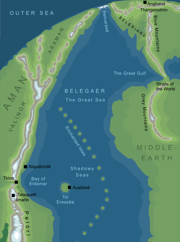
The wide ocean between Aman and Middle-earth
Pronunciation
be'legire ('g' as in English 'guide'; 'ire' to rhyme with 'fire' or 'tire')
Meaning
'Great Sea'1
Bays and gulfs
Islands
Enchanted Isles, Himling, Isle of Balar, Isle of Meneltarma, Númenor, Shadowy Isles, Tol Morwen, Tolfalas
Other names
Titles
|
BelegaerThe Great Sea
The northern parts of Belegaer (somewhat conjectural)2
The northern parts of Belegaer (somewhat conjectural)2
The Great Sea; the mighty ocean that lay between Middle-earth in the east and Aman in the west, in the midst of which the island kingdom of Númenor lay during the Second Age. Notes
See also...Arda, Belthil, Dark Elves, Elves, Elves of the Havens, Encircling Sea, Gaerys, Great Sea of the West, Great Water, Inner Seas, Sea-elves, Sundering Seas, The Great For acknowledgements and references, see the Disclaimer & Bibliography page. Original content © copyright Mark Fisher 1998, 2000, 2002, 2014. All rights reserved. For conditions of reuse, see the Site FAQ. Website services kindly sponsored by Axiom Discovery aptitude and skill testing.Axiom Discovery gives you comprehensive online aptitude testing covering core skills across a wide range of disciplines. |